How to Get to Malandeg Trail Camp
Location: Malandeg Outdoors, Kalasungay, Malaybalay City
Planning your trip up the mountain? Here’s the official route guide—simple, clear, and straight to the point.
Important: The road going to Malandeg Trail Camp / Malandeg Outdoors is not yet registered on Google Maps, so please follow the steps below and don’t rely on Google Maps alone.
Notice (Important)
The road going to Malandeg Trail Camp / Malandeg Outdoors is not yet registered on Google Maps.
Please make sure you:
- Save this direction guide
- Download and save the GPX file we provided
- Refer to the map images with notes for proper guidance
Do not rely solely on Google Maps navigation, as it may not lead you to the correct access road.
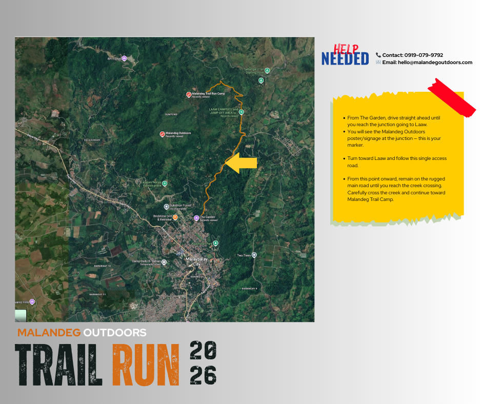
Step 1: From The Garden – Junction to Laaw
From The Garden, drive straight ahead until you reach the junction leading to Laaw.
🔔 You will see the Malandeg Outdoors poster/signage at the junction — this is your marker. 👉 Turn LEFT toward Laaw and follow the single access road.
Step 2: From Laaw Campsite Onwards
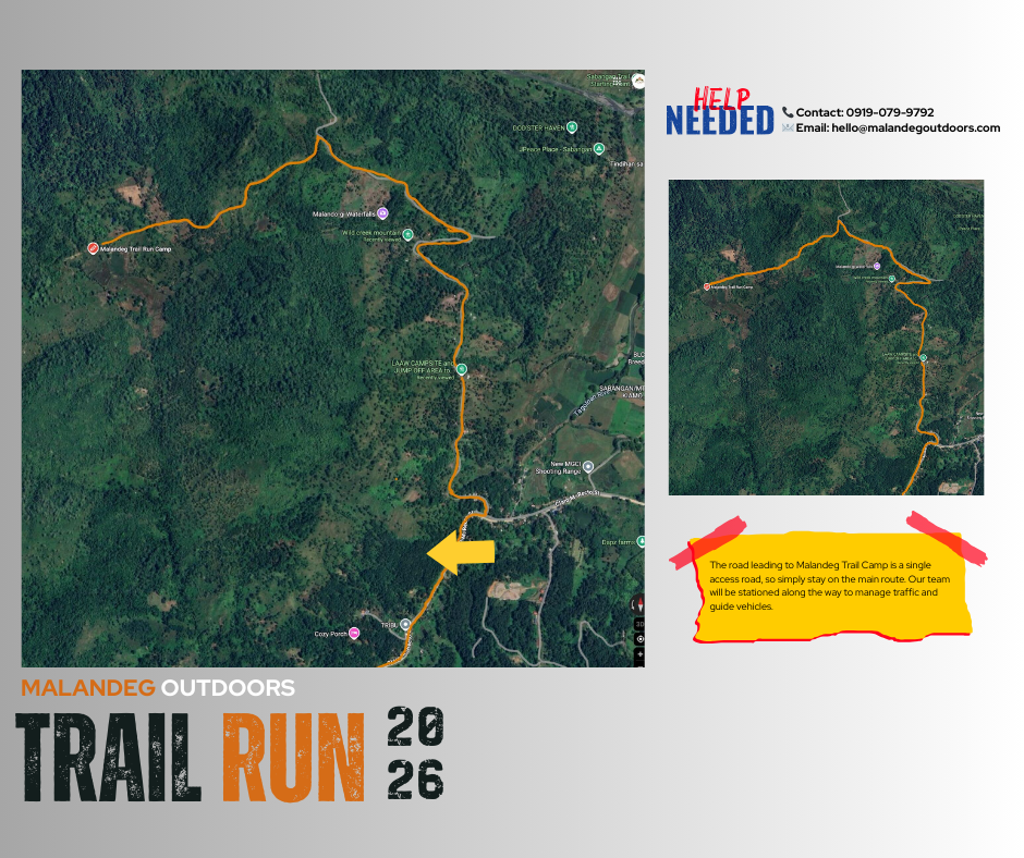
- Continue driving until you reach Laaw Campsite & Jump-Off Area.
- From this point onward, remain on the rugged main road until you reach the creek crossing.
- Carefully cross the creek and continue toward Malandeg Trail Camp.
After the creek:
- The road leading to Malandeg Trail Camp becomes a single access road.
- There are no confusing intersections from this point.
- Simply stay on the main road.
Route Support & Traffic Management
To ensure smooth access, our team will be positioned along the route:
- ✅ Event marshals will be stationed along the route
- ✅ Traffic personnel will assist and guide vehicles
- ✅ Directional signages are installed
You will be guided all the way to the Malandeg Outdoors Gate and onward to Malandeg Trail Camp.
Signal & Travel Advisory
- 📶 Mobile signal may be intermittent in certain mountain areas
- ✅ Please save all maps and GPX files before leaving the city
- ⏱️ Estimated travel time from The Garden: 25–35 minutes (depending on road and weather conditions)
- 🚙 Recommended vehicle: SUV / 4x4 / high-clearance vehicle
- 🪨 Road condition: Rocky and uneven after the creek crossing
Quick reminder: mobile signal can be intermittent—so please save this guide before departure.